African Geomatics
Mapping and GIS Services
A geographic information system (GIS) is a computer system for capturing, storing, displaying and analyzing spatial and geographic data, i.e. data related to positions on Earth's surface. For the use of any GIS it is important to have a thorough knowledge of geodetic datums and map projections.
There are many different types of GIS applications.
At African Geomatics we use it mainly for data collection and storage of large amounts of spatial information, ensuring data consistency, database queries as well as surface modelling.
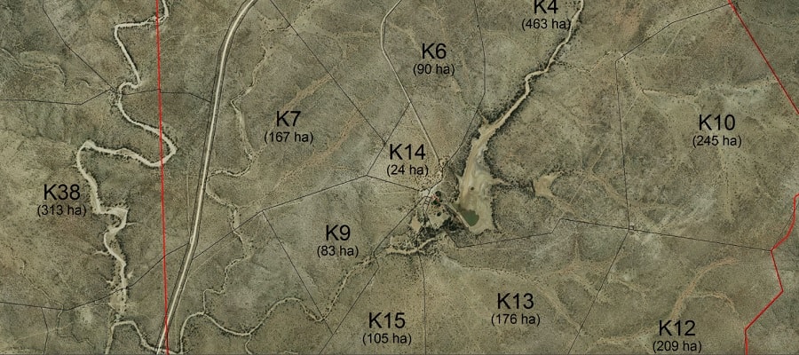
Our GIS system is an essential tool for planning and logistical purposes of our survey projects.
At African Geomatics we use it mainly for data collection and storage of large amounts of spatial information, ensuring data consistency, database queries as well as surface modelling.
Our GIS system is an essential tool for planning and logistical purposes of our survey projects.
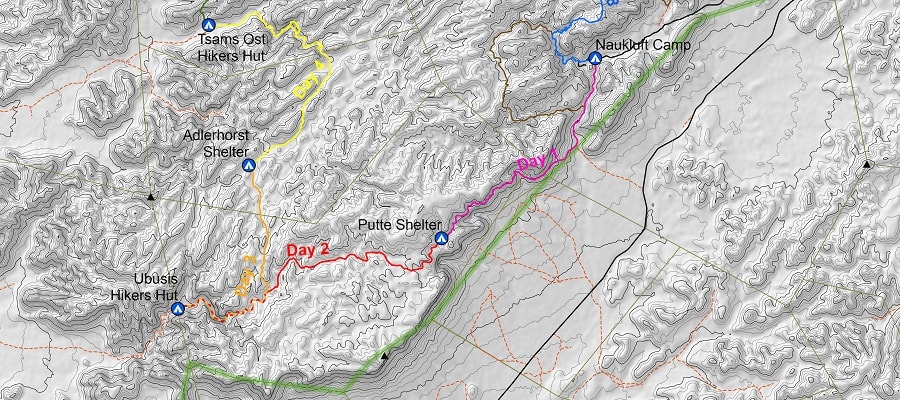
Digital mapping is the process by which a collection of data is compiled and formatted into a virtual image. The primary function of this technology is to produce maps that give accurate representations of a particular area.
The sources of data for digital mapping are endless and include satellite imagery, ortho-imagery from the Surveyor-General’s office, older maps, etc.
This type of mapping is often interesting for farmers who want a map of their farm showing all fences and other infrastructure, as well as the camo sizes. But there are many other applications such as maps for hiking trails, self-drive vehicles in parks, etc.
This type of mapping is often interesting for farmers who want a map of their farm showing all fences and other infrastructure, as well as the camo sizes. But there are many other applications such as maps for hiking trails, self-drive vehicles in parks, etc.
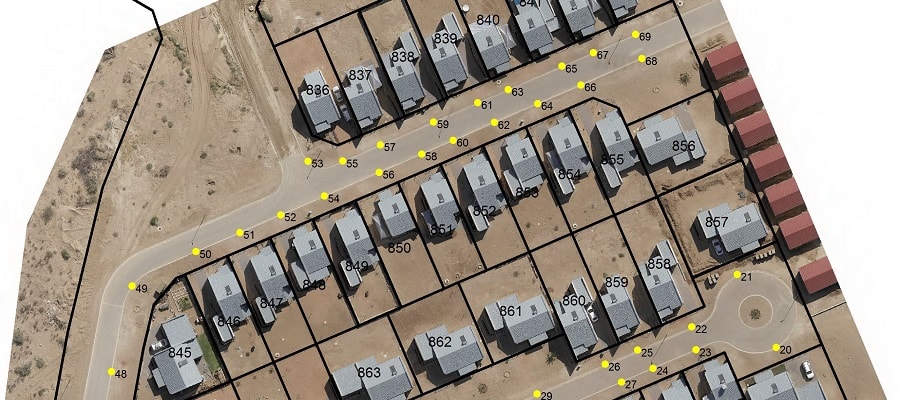
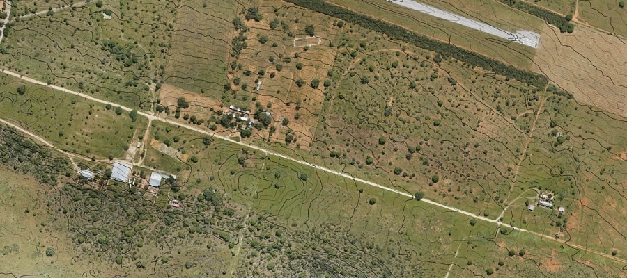
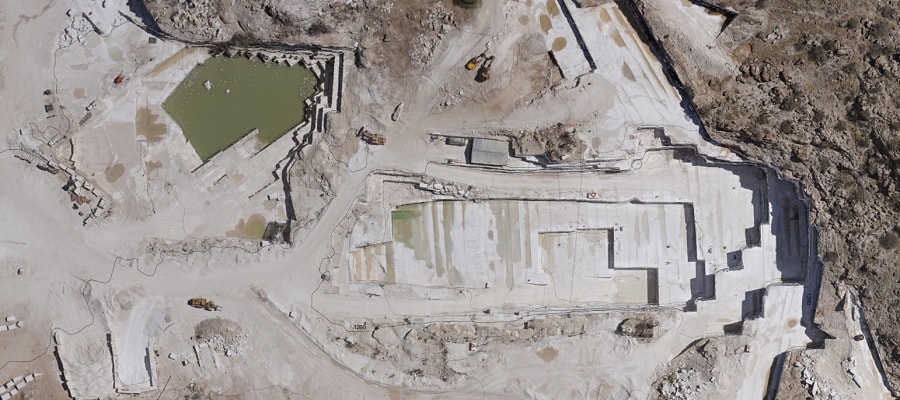
Drone mapping is the same as digital mapping, but the source data is produced in-house by utilizing UAVs and photogrammetry, see UAV Surveys. This type of mapping is generally of much more detail then digital mapping, and depending on the size of the area to be mapped can be as accurate as 1cm.
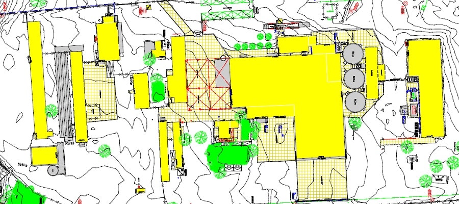
There are a lot of applications for aerial mapping. Base map production for road and road intersection design is one, but it is also very relevant to extensions of existing buildings and even the survey of new sectional titles.
There are a lot of applications for aerial mapping. Base map production for road and road intersection design is one, but it is also very relevant to extensions of existing buildings and even the survey of new sectional titles.
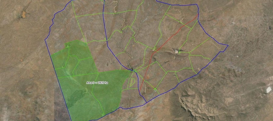
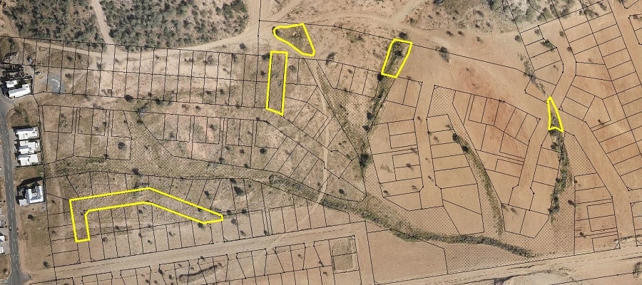
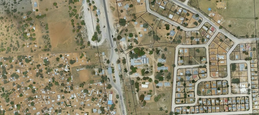
Digitizing is the process by which coordinates from a map, image, or other sources of data are converted into a digital format in a GIS. This data can then be used to simply produce maps, to make analysis, etc.
Currently our main emphasis of digitizing is the process of digitizing townships from general plans filed at the Surveyor-General’s office. Most of these digitized general plans are used in house for surveying planning purposes, but these can also be digitized on demand.
Currently our main emphasis of digitizing is the process of digitizing townships from general plans filed at the Surveyor-General’s office. Most of these digitized general plans are used in house for surveying planning purposes, but these can also be digitized on demand.