African Geomatics
Geodetic Surveys
Geodetic Surveys are precise surveys in which the shape and size of the earth is considered. They are used for long distances and large control networks. Precise instruments and surveying methods as well as specialised processing methods are required.
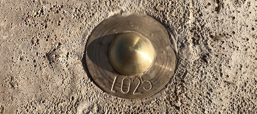
Survey Control points are used in many ways and are established for various reasons.
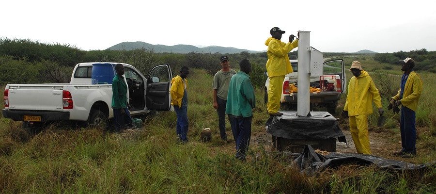
In Namibia there are primary control points which are/were established under the authority of the Surveyor-General. These control points form the backbone to any subsidiary survey in that all surveys need to be connected to this primary network.
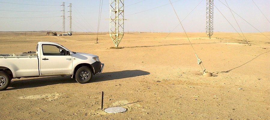
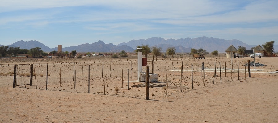
Most other Survey Control points are established project specific, e.g. for powerline construction, road and railway construction, etc.
Our firm has been involved in all sorts of survey control establishment throughout the years.
In Namibia there are primary control points which are/were established under the authority of the Surveyor-General. These control points form the backbone to any subsidiary survey in that all surveys need to be connected to this primary network.
Most other Survey Control points are established project specific, e.g. for powerline construction, road and railway construction, etc.
Our firm has been involved in all sorts of survey control establishment throughout the years.
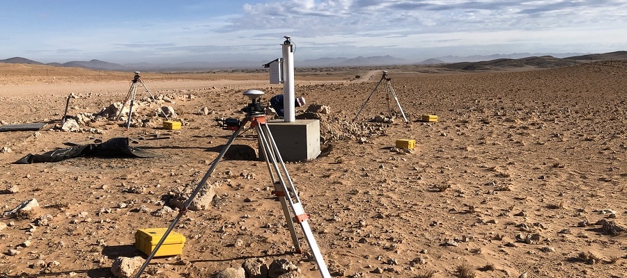
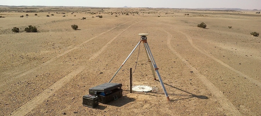
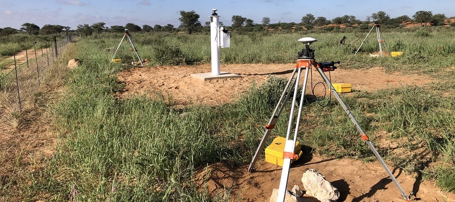
All control points that were established need to be surveyed. The most common method to survey control points is with GNSS survey methods. Depending on the spacing of the control points, whether it be on a National or only a regional level, the main difference during the survey of the control points is the observation times of the GNSS observations.
Our firm has various different models of GNSS equipment which can be used for different project sizes. In total we have 10 geodetic receivers for static survey on a national or regional basis, 7 single frequency GPS receivers for smaller areas, and 4 RTK GNSS receivers for less precise control surveys.
Our firm has various different models of GNSS equipment which can be used for different project sizes. In total we have 10 geodetic receivers for static survey on a national or regional basis, 7 single frequency GPS receivers for smaller areas, and 4 RTK GNSS receivers for less precise control surveys.
All GNSS observations need to be processed to result in final coordinates of control points. Depending on the accuracy requirements and on the project size different processing strategies and software can be used for this purpose.
Our firm uses the Bernese scientific GNSS processing software for the most precise geodetic processing on a National Level. These processing projects were carried out mainly for the Surveyor-General’s office. We also use Trimble’s Business Centre, Graphnav/Grafnet, and various other GNSS processing software, depending on the specific projects' need.
Our firm uses the Bernese scientific GNSS processing software for the most precise geodetic processing on a National Level. These processing projects were carried out mainly for the Surveyor-General’s office. We also use Trimble’s Business Centre, Graphnav/Grafnet, and various other GNSS processing software, depending on the specific projects' need.
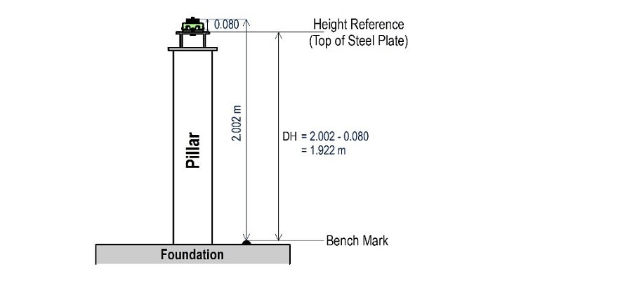
Spirit Levelling is used to measure the height of specified points relative to a Levelling datum. It is used in Geodetic surveys to establish the heights of the main control points of the geodetic infrastructure, but is also used in engineering and construction surveys, e.g. road construction, canals, etc.
Our firm has two digital spirit levels and has completed many thousand km’s of single line levelling in Namibia.
Our firm has two digital spirit levels and has completed many thousand km’s of single line levelling in Namibia.